23Jun
How Ocean Data Affects Marine Fisheries Sustainability
What is ocean data in fisheries management?
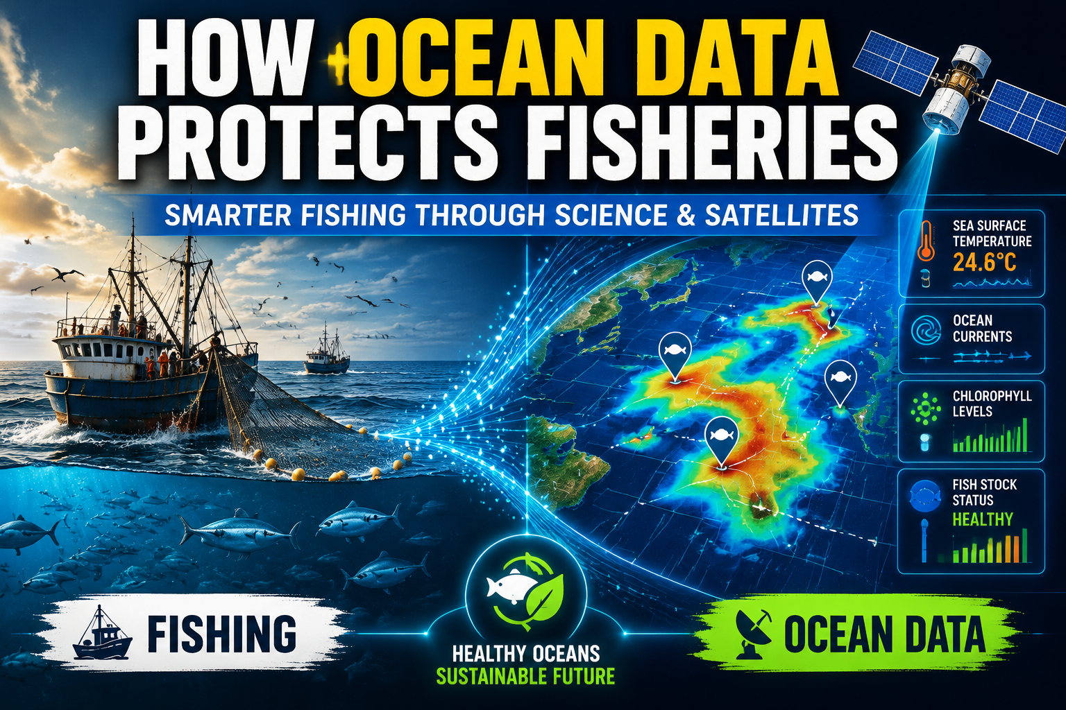
Ocean data refers to scientific measurements collected from oceans using satellites, sensors, research vessels, and floating buoys. This includes sea surface temperature, salinity, oxygen levels, currents, chlorophyll concentration, and marine species distribution patterns.
When applied to fisheries, this data helps scientists and policymakers understand where fish populations live, how they move, and how environmental changes affect their survival. Platforms like Oceanography provide access to ocean datasets and tools that support marine research and sustainability analysis.
Why fisheries sustainability depends on ocean data
Fish populations are not static. They move based on temperature, food availability, oxygen levels, and ocean currents. Without data, fisheries management relies on outdated assumptions or historical catch records.
Ocean data changes this by providing real-time insights into marine ecosystems. This helps prevent overfishing and supports long-term ecological balance.
For example, if sea surface temperatures rise in a region, fish may migrate to cooler waters. Without monitoring this shift, fishing fleets might target depleted zones, accelerating stock collapse.
Key types of ocean data used in fisheries
1. Sea surface temperature (SST)
Temperature strongly influences fish migration. Many species move only a few degrees of temperature change.
2. Chlorophyll concentration
This indicates plankton abundance, which is the base of the marine food chain. High chlorophyll often means more fish activity.
3. Ocean currents
Currents affect spawning patterns, larval distribution, and nutrient transport.
4. Oxygen levels
Low oxygen zones (hypoxia) can push fish away or reduce survival rates.
5. Satellite tracking data
Satellites monitor large-scale ocean changes and help map fish habitats indirectly.
How ocean data improves fisheries sustainability
Better fish stock predictions
Oceanographic models combine environmental signals with historical catch data to estimate fish population sizes more accurately.
Smarter fishing zones
Authorities can define dynamic fishing zones based on real-time data instead of fixed geographic boundaries.
Reduced overfishing
By tracking migration and breeding cycles, fishing pressure can be reduced during vulnerable periods.
Climate adaptation
As oceans warm, fish distributions shift. Ocean data helps fisheries adapt to these changes instead of reacting too late.
Role of satellite technology in fisheries
Satellites are essential for modern fisheries management. They provide continuous global coverage of ocean conditions.
They help detect:
- Temperature anomalies
- Algal blooms
- Currents and eddies
- Seasonal migration trends
These insights allow governments and organizations to adjust quotas and fishing regulations dynamically.
Ocean data and fish stock modeling
Fish stock models use mathematical and machine learning techniques to estimate population size and health.
Inputs include:
- Historical catch data
- Environmental conditions
- Species reproduction rates
- Migration patterns
These models help answer critical questions like:
- How many fish can be sustainably caught?
- Which regions are at risk of depletion?
- How will climate change affect future stocks?
Challenges in using ocean data
Despite its importance, ocean data has limitations:
- Data gaps in deep ocean regions
- Limited tracking of certain species
- High cost of advanced monitoring systems
- Uncertainty in predictive models
- Delayed integration into policy decisions
These challenges make collaboration between scientists, governments, and technology platforms essential.
Future of fisheries management
The future of fisheries sustainability lies in real-time ocean intelligence systems. These systems will integrate:
- Satellite data feeds
- AI prediction models
- Autonomous ocean sensors
- Fisheries catch reporting systems
This will allow near real-time decision-making for fishing quotas and protected zones.
Platforms like Oceanography are expected to play a key role in enabling access to open ocean datasets for research and policy development.
Conclusion
Ocean data is transforming fisheries sustainability by replacing guesswork with evidence-based decision-making. By analyzing environmental conditions and marine ecosystem behavior, scientists can better protect fish populations while supporting global food security.
As climate change accelerates ocean shifts, data-driven fisheries management will become essential for maintaining balance between human demand and marine conservation.
Discover how ocean data is transforming fisheries sustainability, climate research, and marine ecosystem understanding.
Access tools, datasets, and research insights on Oceanography.
FAQs
1. What is ocean data in fisheries?
Ans: Ocean data includes environmental measurements like temperature, salinity, and chlorophyll levels used to understand fish habitats and movement.
2. How does ocean data help fisheries sustainability?
Ans: It helps predict fish populations, reduce overfishing, and design smarter fishing zones based on real-time environmental conditions.
3. What technologies collect ocean data?
Ans: Satellites, buoys, underwater sensors, and research vessels are the main tools used for ocean data collection.
4. What types of ocean data are used in AI marine migration prediction?
Ans: AI models use satellite data, sea temperature, salinity, chlorophyll levels, ocean currents, and tagged marine species data to predict migration patterns. NOAA provides key ocean datasets for this research.
5. How do satellites support fisheries?
Ans: They monitor ocean conditions like temperature and currents over large areas, helping track fish habitats indirectly.
6. What is fish stock modeling?
Ans: It is the use of data and mathematical models to estimate fish population size and predict sustainable catch limits.
7. Can ocean data prevent overfishing?
Ans: Yes, it helps identify safe fishing limits and vulnerable breeding periods, reducing the risk of overexploitation.
8. What role does climate change play?
Ans: Climate change alters ocean conditions, forcing fish to migrate and changing ecosystem balance.
9. What is a good resource for learning ocean AI modeling?
Ans: A strong starting point is NASA Earth Observatory, which provides satellite-based climate and ocean data used in environmental and marine research.
10. Where can I access ocean data?
Ans: You can explore marine datasets and research tools at Oceanography.com.