
16Sep
How Ocean Floor Mapping Works Using Sound Technology
Most of the ocean remains difficult to observe directly because sunlight cannot reach the deepest waters. Scientists cannot simply look through the ocean to understand what lies below. Instead, they rely on sound waves to reveal underwater landscapes hidden beneath the surface.
Ocean floor mapping is the process of creating detailed maps of the seabed using technologies such as sonar. Scientists use sound waves to measure underwater depth, identify geological features, and reveal landscapes including mountains, trenches, volcanoes, and valleys hidden beneath the ocean surface.
Why Scientists Need Maps of the Ocean Floor
The ocean floor is not a flat surface. It contains some of the planet’s most dramatic landscapes, including deep trenches, enormous mountain ranges, and active volcanic regions.
Detailed maps help scientists understand:
- How Earth’s tectonic plates move
- Where underwater habitats exist
- How ocean currents interact with the seabed
- How marine ecosystems develop
- Where resources and hazards may be located
Accurate seafloor information also supports navigation, climate research, coastal management, and disaster preparation.
Although satellites can provide some information about ocean features, their measurements are limited. Direct acoustic surveys create much more detailed views of underwater terrain.
How Sound Reveals the Hidden Ocean
Modern ocean mapping has helped scientists discover and study some of Earth’s most dramatic underwater landscapes. Research vessels equipped with sonar systems have mapped deep ocean trenches, volcanic ridges, and previously unknown seafloor structures.
Global mapping efforts such as Seabed 2030 aim to create a complete digital map of the ocean floor by combining data from research vessels, satellites, and international scientific organizations.
The main technology behind modern ocean exploration is sonar, which stands for Sound Navigation and Ranging.
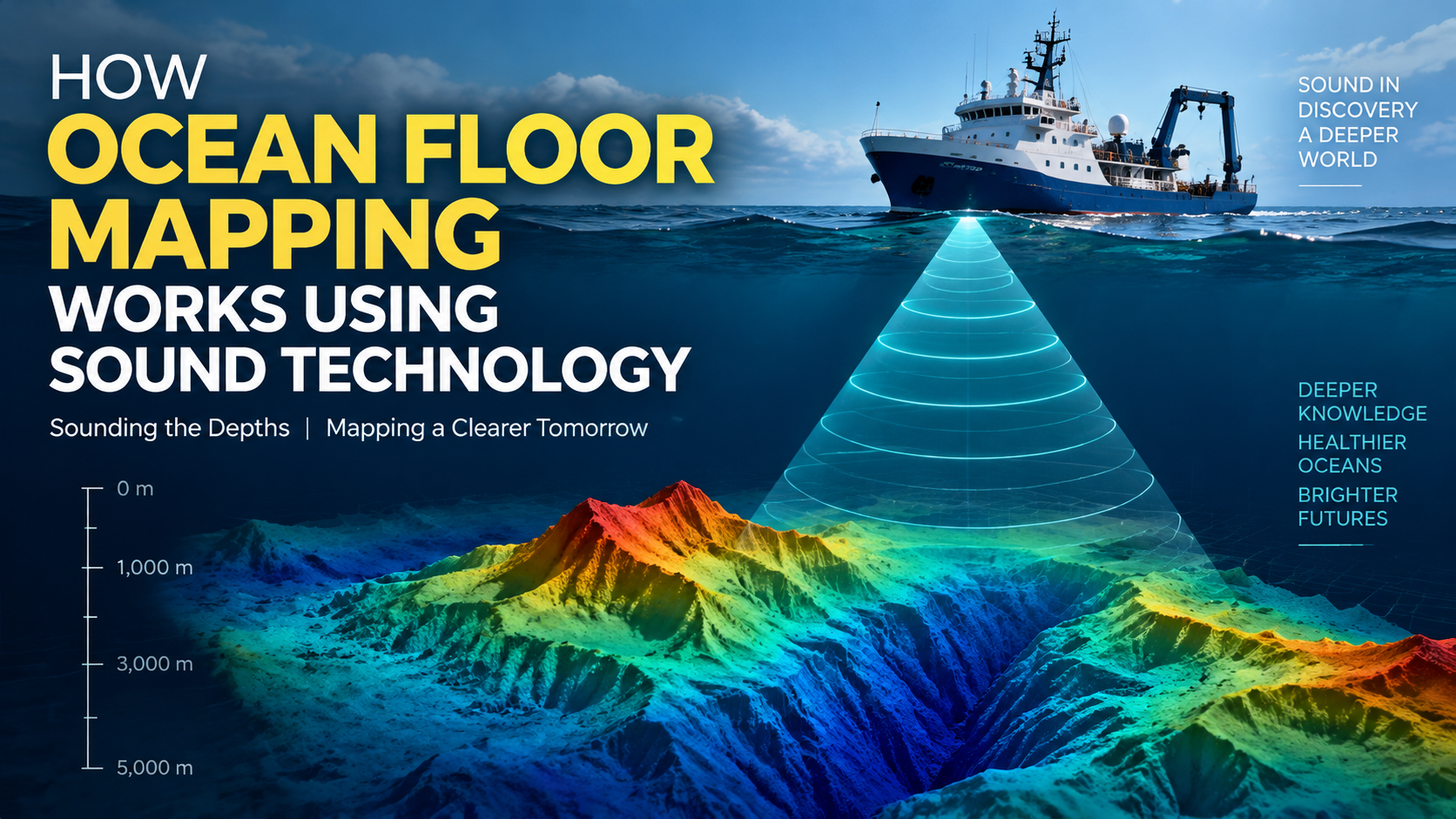
Sonar works by sending sound pulses into the water. When those sound waves hit an object or the seafloor, they bounce back toward a receiver. Scientists measure the time it takes for the echo to return and calculate the distance to the underwater surface.
This process is similar to how bats use sound echoes to navigate. Instead of detecting objects in the air, sonar systems reveal underwater structures.
The basic process involves:
- A vessel sends sound waves into the ocean.
- The waves travel downward until they reach the seabed.
- Echoes return to sensors on the ship.
- Computers analyze the signals.
- Scientists create detailed underwater maps.
The Role of Multibeam Sonar in Modern Exploration
Multibeam sonar does not create photographs of the ocean floor. Instead, it measures sound reflections and converts those measurements into digital elevation models called bathymetric maps.
One of the most advanced tools used in ocean research is multibeam sonar. Unlike older sonar systems that measure only one area at a time, multibeam systems send multiple sound beams across a wide section of the seabed.
This allows researchers to collect thousands of measurements quickly and produce highly detailed three-dimensional maps.
Modern ocean floor mapping projects often depend on multibeam sonar because it provides better coverage and accuracy than traditional methods. Scientists can identify underwater features such as ridges, canyons, and volcanic formations with remarkable detail.
Research vessels equipped with these systems can spend days or weeks collecting data across large sections of the ocean.
Turning Sound Data Into Underwater Maps
Collecting sonar signals is only the first step. Scientists must transform large amounts of acoustic information into useful maps.
Specialized software processes the data by calculating:
- Depth measurements
- Surface shapes
- Terrain changes
- Geological structures
The result is a digital model called a bathymetric map. These maps show underwater landscapes in a way similar to how topographic maps represent mountains and valleys on land.
Through advanced processing, researchers can create detailed visualizations that help scientists study areas that have never been physically explored.
Challenges of Mapping the Deep Ocean
Even with advanced technology, exploring the ocean floor remains challenging.
Deep-sea conditions create several difficulties:
Extreme pressure
At great depths, water pressure becomes intense. Research equipment must be specially designed to survive these environments.
Large distances
The ocean covers more than 70% of Earth’s surface, making complete surveys a massive undertaking.
Changing conditions
Ocean currents, temperature differences, and underwater noise can affect measurements and data collection.
Because of these challenges, scientists continue developing better sensors, autonomous vehicles, and improved mapping techniques.
How Ocean Floor Maps Help Science and Society
Detailed seabed maps support many areas of research and practical work.
Marine biologists use them to locate habitats where unique species may live. Geologists study underwater formations to better understand Earth’s history. Engineers use ocean maps when planning underwater cables, pipelines, and offshore structures.
Ocean floor mapping also plays a role in understanding climate change. The shape of the seabed influences ocean circulation patterns, which affect global climate systems.
Organizations such as Oceanography.com share research and educational resources that help people understand marine science and ocean exploration.
The Future of Exploring Earth’s Largest Environment
New technologies are making ocean research faster and more detailed. Autonomous underwater vehicles, artificial intelligence-assisted analysis, and improved sonar systems are helping scientists explore areas that were previously difficult to study.
Future ocean floor mapping efforts will continue improving our understanding of Earth’s underwater environment. As more data becomes available, scientists can build a clearer picture of the planet’s largest and least explored region.
Conclusion: Listening to the Ocean to Understand It
The ocean floor may be hidden from human eyes, but sound provides a powerful way to explore it. By sending acoustic signals into the deep and analyzing returning echoes, scientists can reveal landscapes thousands of meters below the surface.
From discovering underwater mountains to studying marine ecosystems, ocean floor mapping helps researchers understand how our planet works and how the ocean influences life on Earth.
Continue exploring Oceanography.com to discover how scientists study the deep ocean, map hidden landscapes, and uncover the technologies transforming marine exploration.
FAQs
1. What is ocean floor mapping?
Ocean floor mapping is the process of measuring and creating detailed maps of underwater landscapes. Scientists use technologies such as sonar to identify depths, geological formations, and features on the seabed.
2. Why do scientists use sound to map the ocean floor?
Scientists use sound because sound waves travel effectively through water. By measuring returning echoes, researchers can calculate underwater distances and create accurate representations of the seabed.
3. What technology is used for ocean floor mapping?
The main technology used is sonar, especially multibeam sonar systems. These tools send sound waves into the ocean and collect detailed information about underwater terrain.
4. What is bathymetry in ocean science?
Bathymetry is the measurement of underwater depth and the study of the shape of the ocean floor. Bathymetric maps show underwater features similar to how topographic maps show land features.
5. How accurate are sonar-based ocean maps?
Modern sonar systems can create highly detailed maps of surveyed areas. Accuracy depends on equipment quality, environmental conditions, and the depth of the water.
6. Can satellites map the entire ocean floor?
Satellites can estimate some large-scale ocean features, but they cannot provide the same detailed information as direct sonar surveys conducted by research vessels.
7. What are multibeam sonar systems?
Multibeam sonar systems use multiple sound beams to measure large sections of the seabed at once. They allow scientists to collect detailed underwater measurements efficiently.
8. How long does ocean floor mapping take?
The time required depends on the size and depth of the area being studied. Large ocean surveys can require months or years of research and data processing.
9. How does ocean mapping help marine conservation?
Ocean maps help researchers identify important habitats, understand ecosystems, and plan conservation efforts by revealing underwater environments where marine species live.
10. Where can I learn more about ocean science and exploration?
Educational resources from organizations such as the National Oceanic and Atmospheric Administration ocean exploration program provide information about ocean research, exploration missions, and mapping technologies.
