30Apr
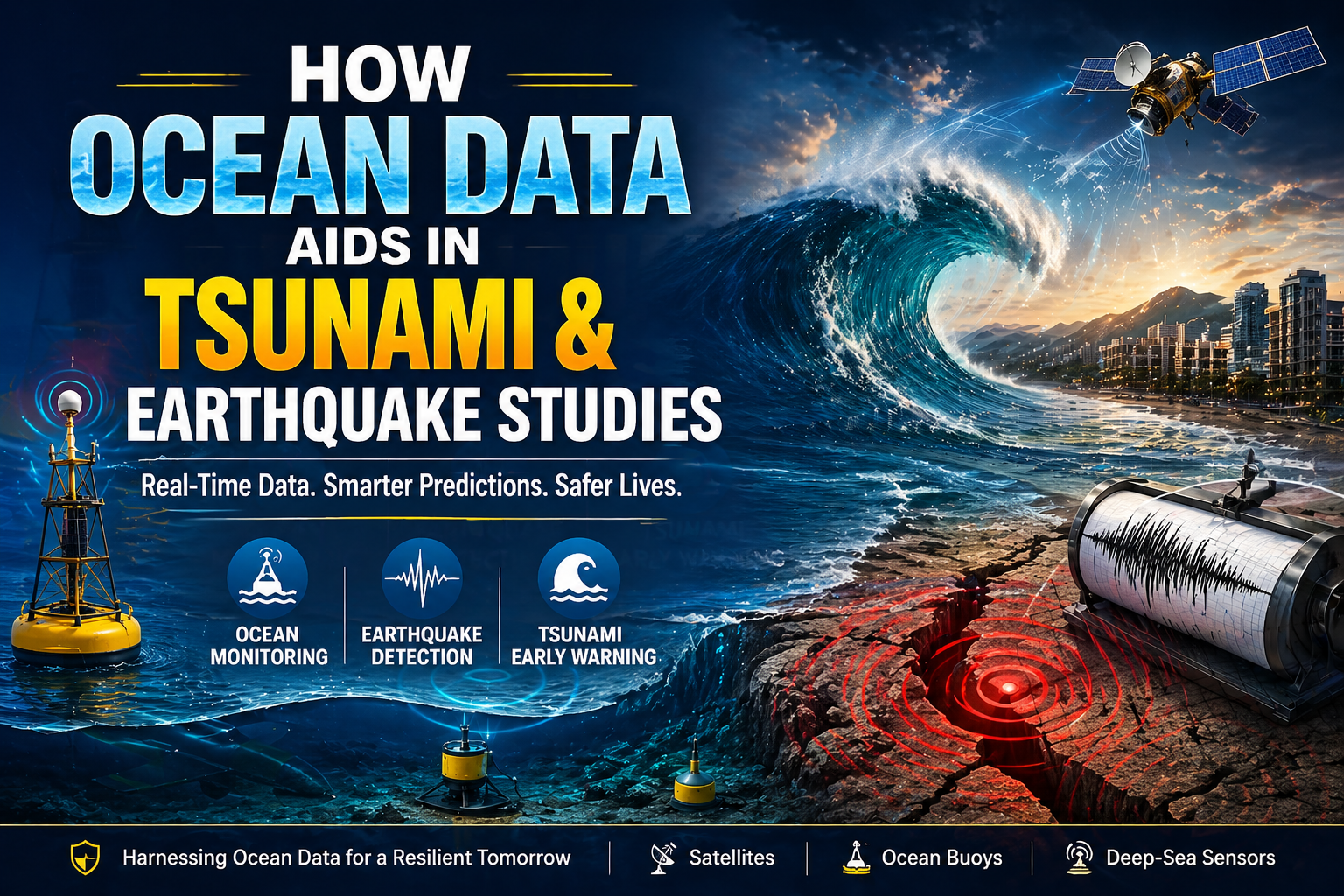
How Ocean Data Aids in Tsunami and Earthquake Studies
Table of Contents
- Introduction to Ocean Data and its Importance
- What is Tsunami and Earthquake Research?
- How Ocean Monitoring Supports Earthquake Studies
- Tsunami Detection Using Ocean Data
- How Ocean Currents Influence Tsunami and Earthquake Studies
- Ocean Data's Contribution to Disaster Preparedness
- The Future of Ocean Data in Natural Disaster Research
- 7.1 Advancements in Oceanography and Seismology
- Conclusion: The Need for Continued Ocean Data in Disaster Studies
- FAQs
Introduction to Ocean Data and its Importance
Ocean data is the backbone of modern-day disaster research, especially when it comes to tsunamis and earthquakes. But, what is ocean data? It includes information collected from ocean sensors, monitoring stations, and seismic equipment. This data helps us understand everything from water temperature and salinity to the seismic activity deep beneath the ocean’s surface. In a world where natural disasters can strike at any time, ocean data provides a lifeline by offering real-time insights and forecasts, allowing us to respond proactively.
Ocean data is also instrumental in predicting the behavior of tsunamis and understanding earthquake patterns. Without accurate ocean monitoring, predicting these catastrophic events would be a shot in the dark. Ocean monitoring systems such as deep-sea sensors and seismic buoys make it possible to detect shifts in the ocean floor, track tsunami waves, and even predict earthquakes before they hit. This technology is not just helpful for scientists, but it saves lives, minimizes property damage, and helps communities prepare for the worst.
Key Takeaways
- Ocean data is critical for monitoring and predicting tsunamis and earthquakes.
- Seismic sensors and ocean buoys help detect seismic activity and early tsunami warnings.
- Ocean currents play an important role in understanding tsunami and earthquake patterns.
- Continuous advancements in oceanography and seismology improve our ability to predict natural disasters.
What is Tsunami and Earthquake Research?
Tsunami and earthquake research is the study of these natural disasters how they form, how they behave, and most importantly, how we can predict them. Tsunamis are typically triggered by seismic events like underwater earthquakes or volcanic eruptions. Earthquakes, on the other hand, occur when tectonic plates shift beneath the Earth’s surface, causing vibrations that can be felt on land.
By studying seismic waves, oceanic shifts, and underwater faults, researchers can gain insights into how and when these disasters might occur. Ocean data plays a huge part in this research by providing real-time data on sea level fluctuations, seismic activity, and ocean currents. This helps scientists understand the dynamics of both tsunamis and earthquakes and improve their predictive capabilities.
How Ocean Monitoring Supports Earthquake Studies
Ocean monitoring is indispensable when it comes to earthquake studies. Oceans cover more than 70% of the Earth’s surface, and many of the world’s most dangerous earthquakes occur under the ocean. By monitoring seismic waves and underwater faults, scientists can understand how earthquakes propagate across the Earth.
The Role of Seismic Sensors in Earthquake Detection
Seismic sensors are like the “ears” of earthquake research. These sensors are placed on the ocean floor or along coastlines to detect shifts in the Earth’s crust. When an earthquake occurs, seismic sensors pick up the vibrations (known as seismic waves) and send data to researchers. This data helps determine the earthquake’s location, strength, and potential impact.
The real benefit of these sensors is their ability to detect earthquakes in real-time, which is crucial for issuing early warnings and evacuations. Without these sensors, we would be left in the dark when it comes to earthquake preparedness.
Ocean Data in Early Earthquake Prediction
One of the key challenges in earthquake research is predicting when and where they will occur. While no system is perfect, ocean data has provided invaluable insights into earthquake prediction. Researchers analyze shifts in the ocean floor, temperature changes, and seismic activity to spot patterns that could indicate an impending earthquake.
By using this data, scientists can issue warnings for earthquakes long before they strike. Ocean data serves as an early warning system that helps minimize damage and protect communities.
Tsunami Detection Using Ocean Data
Tsunamis are fast-moving waves caused by underwater seismic activity. Detecting them early is crucial for saving lives. Ocean data helps in tsunami detection by providing continuous real-time information about changes in the ocean floor, water pressure, and wave movement.
Ocean Buoys and Tsunami Early Warning Systems
Ocean buoys are key players in tsunami detection. These buoys float on the ocean’s surface and are equipped with sensors that can measure changes in water pressure, temperature, and movement. When an earthquake triggers a tsunami, these sensors detect the changes and send the data to warning centers. By measuring the size, speed, and direction of the tsunami waves, ocean buoys help predict how soon the tsunami will reach land.
These early warnings can save lives by giving coastal communities time to evacuate before the tsunami strikes.
The Role of Deep-Sea Sensors in Tsunami Prediction
Deep-sea sensors are often deployed on the ocean floor to monitor seismic activity and ocean floor shifts. These sensors can detect even the slightest changes in the Earth’s crust, helping scientists track the movements that cause tsunamis. By combining data from these sensors with information from ocean buoys, scientists can more accurately predict tsunami waves and their impact on coastal regions.
How Ocean Currents Influence Tsunami and Earthquake Studies
Ocean currents play a significant role in how tsunamis behave once they are triggered. The direction and speed of ocean currents can either amplify or weaken tsunami waves. Similarly, understanding how ocean currents interact with seismic waves helps scientists understand the full scope of an earthquake’s impact.
The Impact of Ocean Currents on Tsunami Waves
When a tsunami is triggered, the movement of ocean currents can either hasten or delay the arrival of tsunami waves. By studying these currents, scientists can better predict the timing and strength of the tsunami waves that will hit land. Understanding ocean currents allows for more accurate forecasting of tsunami behavior.
How Ocean Currents Help Predict Earthquake-Triggered Tsunamis
Earthquakes can trigger tsunamis by displacing large volumes of water. Ocean currents help track the movement of this displaced water and predict the waves’ arrival times. By monitoring ocean currents before, during, and after seismic events, researchers can gain a clearer understanding of how earthquakes will impact surrounding areas.
Ocean Data's Contribution to Disaster Preparedness
Disaster preparedness is critical in minimizing the impact of tsunamis and earthquakes. Ocean data contributes to preparedness efforts by improving early warning systems, response strategies, and the overall understanding of these disasters.
Improving Tsunami Warning Systems with Ocean Data
Tsunami warning systems rely heavily on real-time ocean data to issue alerts when a tsunami is approaching. By utilizing ocean buoys, deep-sea sensors, and other monitoring equipment, these systems provide vital information on the wave’s size, speed, and direction. This data allows authorities to issue warnings in advance, giving communities time to evacuate.
How Ocean Data Helps in Earthquake Impact Mitigation
In addition to predicting tsunamis, ocean data also helps mitigate the impact of earthquakes. By understanding seismic activity and ocean floor movements, researchers can develop better infrastructure, emergency response plans, and evacuation routes to minimize damage in earthquake-prone areas.
The Future of Ocean Data in Natural Disaster Research
The field of ocean data research is constantly evolving. New technologies and innovations in oceanography and seismology are improving our ability to predict tsunamis and earthquakes. These advancements will play a critical role in enhancing disaster prediction and preparedness efforts worldwide.
Advancements in Oceanography and Seismology
As technology continues to advance, so does our ability to monitor and predict natural disasters. New sensors, data analytics tools, and oceanic monitoring systems are allowing scientists to gain even more precise data on seismic activity and tsunami waves. These advancements will continue to improve our ability to forecast and respond to disasters, saving lives and reducing damage.
Conclusion: The Need for Continued Ocean Data in Disaster Studies
Ocean data plays a vital role in tsunami and earthquake studies, helping us detect, predict, and mitigate the impacts of these natural disasters. As technology continues to advance, the value of ocean data will only grow. Continued investment in ocean data research is crucial for improving our disaster preparedness, enhancing early warning systems, and ultimately saving lives.
Explore More on Ocean Data and Disaster Research
FAQs
1. What is ocean data?
Ocean data refers to the information collected from various sensors and monitoring systems in the ocean, which helps researchers understand ocean conditions and seismic activity.
2. How do seismic sensors help detect earthquakes?
Seismic sensors detect ground vibrations caused by seismic waves, providing real-time data that helps researchers monitor earthquake activity.
3. What is the role of ocean buoys in tsunami detection?
Ocean buoys measure changes in water pressure and wave movement, providing real-time data to predict and track tsunami waves.
4. How can ocean currents affect tsunami waves?
Ocean currents can either amplify or weaken tsunami waves, affecting how quickly they reach coastal areas and their potential impact.
5. Can ocean data predict earthquakes?
While predicting earthquakes remains challenging, ocean data helps researchers identify patterns and trends in seismic activity, aiding in early warnings.
6. How do deep-sea sensors contribute to tsunami prediction?
Deep-sea sensors monitor underwater seismic activity and shifts in the ocean floor, helping scientists predict tsunami waves with greater accuracy.
7. Why is ocean data important for disaster preparedness?
Ocean data enhances early warning systems and provides critical insights into how tsunamis and earthquakes will behave, allowing communities to prepare in advance.
8. What advancements are being made in oceanography for disaster research?
New technologies, such as improved sensors and data analytics tools, are helping researchers gain more precise data for predicting natural disasters.
9. How do ocean currents help predict earthquake-triggered tsunamis?
Ocean currents track the movement of displaced water after an earthquake, helping scientists predict the tsunami waves that may follow.
10. What is the future of ocean data in disaster research?
Continued advancements in oceanography and seismology will improve our ability to predict, monitor, and respond to tsunamis and earthquakes.